Category: Geography
-
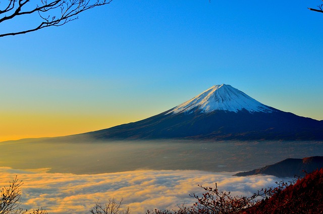
Mount Fuji Facts For Kids | Highest Peak In Japan
Mount Fuji is situated on Honshu Island in Japan and it is by far the biggest Japanese peak. The most eye-catching feature of Mount Fuji is that the top section is covered with ice. Its shape is highly symmetrical. Now let’s explore this wonderful Japanese peak and see what it brings to us in Mount…
Written by
-
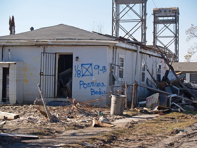
Hurricane Katrina Facts For Kids | The Costliest US Disaster
Hurricane Katrina is basically a tropical cyclone that occurs mostly within a period of 6 months starting from June and ends on the last day of November. Thus, fall and summer seasons are the most likely seasons for hurricanes. It originates over North Atlantic Ocean. Such kinds of tropical cyclones are numbered according to the…
Written by
-
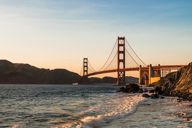
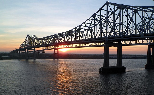
Golden Gate Bridge Facts For Kids
There was no route to reach San Francisco from Marin County before the completion of Golden Gate Bridge. The Ferry service was therefore, introduced in 1820 as the only way between Marin County and San Francisco. In 1916, the proposal for the construction of Golden Gate Bridge was made. Let’s discover more in Golden Gate…
Written by
-
Bermuda Triangle Facts For Kids | The Devil’s Triangle
Bermuda triangle is a loosely defined area in the western North Atlantic Ocean where everything seems to disappear. The triangle stretches from the island of Bermuda to Miami while going through the southern Florida extending through Puerto Rico to as far as 15o C North Latitude then again comes back to Bermuda. This region is…
Written by
-
South America Facts For Kids
South America is the world’s fourth largest continent by area. It has the world’s largest rivers and rainforests and the continent offers a wide variety of deserts from the world’s wettest to the driest regions. The continent is situated at the south of Panama and Central America. It is often referred to as the subcontinent…
Written by
-
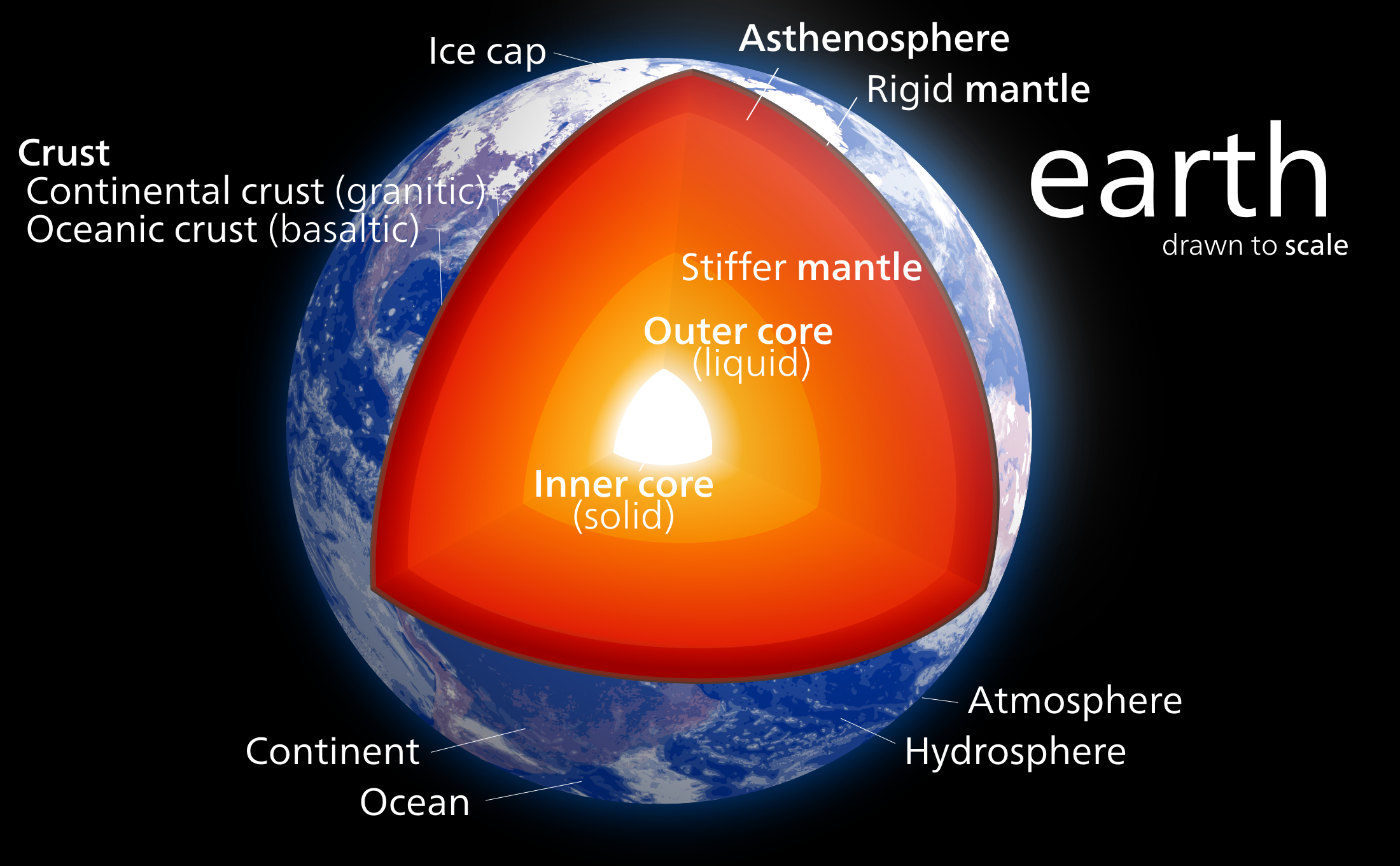
Layers Of The Earth For Kids | Crust, Mantle And Core
Earth is made up of three layers and each of these has different properties. These are the Crust, the Mantle and the Core. However, these layers are further broken down into sub-layers. The crust is made up of two sub-layers; oceanic crust and continental crust. The mantle is divided into two portions; upper mantle and…
Written by
-
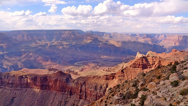
Grand Canyon Facts For Kids | Ancient Landscape
Grand Canyon is one of the most wonderful landscapes in the world. The canyon is carved by Colorado River some 6 million years ago which according to geologists is quite young landscape. Nonetheless, geologists have found some rocks in the Grand Canyon that are billion years old which means that it tells us the entire…
Written by
-
Mississippi River Facts For Kids | Third Largest Basin
iveThe Mississippi river system is the largest drainage basin in the North America, draining 41% of the states of America. It flows through the heart of United States. The river is ranked as the third largest basin in the world—only after Amazon and Congo Basins. It starts from the Lake Itasca in Minnesota and runs…
Written by
-
Amazon River Facts For Kids | The Second Longest River
Amazon River is in South America and is surrounded by thick amazon rainforest. The snake-like River is a magnificent river for it is home to millions of animals and plants. Almost one-third of all species in the world are found in Amazon Rainforest. Let’s discover some more amazon river facts for kids! Amazon River Facts…
Written by
-
Boxing Day Tsunami Facts | Deadliest disaster
On Dec 26, 2004 earthquake occurred under the Indian Ocean and strikes different countries that were situated on the coastal areas. The magnitude of the tsunami was measured at 9.1 on Richter scale. The quake is referred to as “Boxing Day Tsunami”. Boxing Day Tsunami Facts The depth of the quake was 30 km beneath…
Written by

-
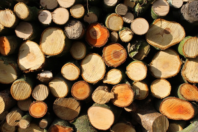
Deforestation Facts For Kids | Facts About Deforestation For Kids
Deforestation is an extremely important concept to be familiar with because it has had huge impacts on everyday lives of people all over the world. So let’s explore this concept in deforestation facts for kids and see why this matter is gaining so much importance these days. Deforestation Facts For Kids What Does Deforestation Mean…
Written by
-
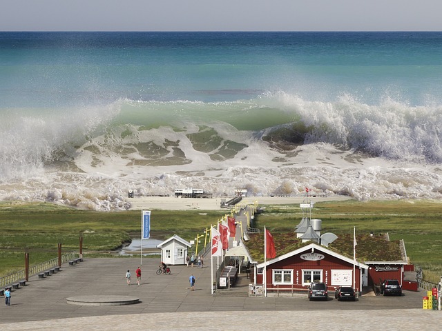
Tsunami Facts for Kids | Facts about Tsunami
Tsunami is a series of gigantic waves that are caused due to the underwater earthquake. It so happens that the earthquake under water pushes the water upward because the plates collide with each other and as it turns out the wave gets bigger and bigger and travel at a high speed. Unlike regular waves, tsunami…
Written by
-
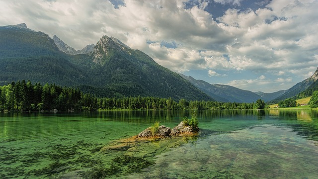
Mountain Facts for Kids | Interesting Facts
Mountains are formed when tectonic plates collide with each other and the planet’s crust is subjected to great forces. Unlike few that can stand independently in summit, most mountains are part of the ranges. Mountains are generally eaten away by rivers, weather conditions, and glaciers even though the erosion takes place very gradually. Mountain Facts…
Written by
-
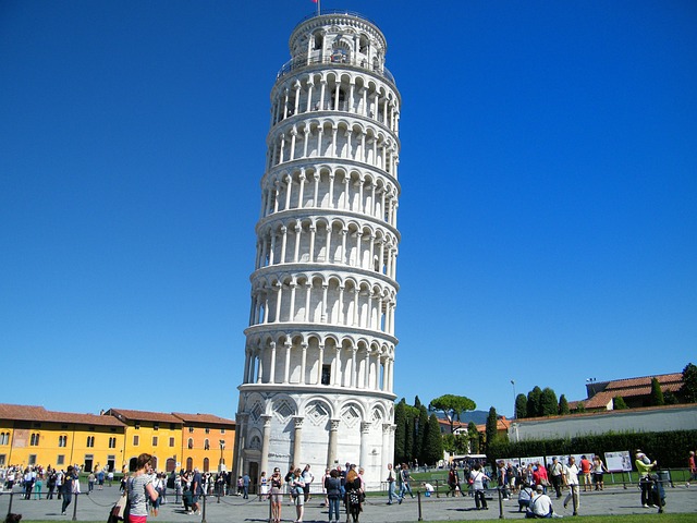
Leaning Tower Of Pisa Facts For Kids | The Bell Tower
The leaning tower of Pisa is certainly one of the wonderful structures that stands out in its unique and strange appearance. What’s more exciting about it is the fact that despite its slanting look, it is as good as any other building that can stand the test of time. It is just the tip of…
Written by
-
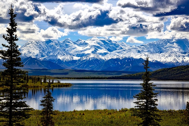
Facts About Alaska For Kids | The Largest State of USA
Alaska is situated at the northwest of Canada and is the largest U.S. state. Alaska has a diverse geography with wide-open spaces, mountains, lakes and forests. The flora and fauna if this state is very unique, abundant and amazing, which attracts thousands of tourists who seeks wildlife adventures. Here we have many facts about Alaska for…
Written by
-
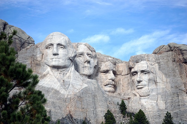
Mount Rushmore Facts For Kids | The Biggest Work of Art in the World
There couldn’t be a better way to pay a mark of respect to those who changed the course of history than by building a monument that was to become a hallmark for the entire country. Located on the Black Hills of South Dakota, Mount Rushmore is certainly one such feat that stands out in terms…
Written by
-
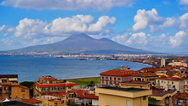
Mount Vesuvius Facts For Kids | The Most Active Volcano in Europe
The Vesuvius is probably the most active volcano in the entire Europe which is believed to have caused as much damage as any other volcanic eruption. The volcano has long been admired for its silent yet deadly nature to the inhabitants of Europe and to the residents of Southern Italy in particular. Mount Vesuvius Facts For…
Written by
-
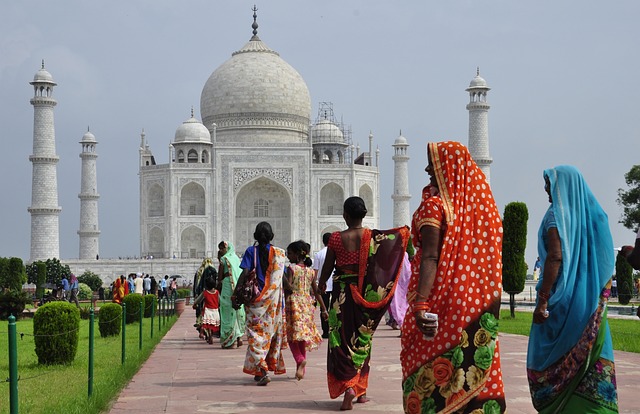
Taj Mahal Facts for Kids | Rare Facts about Taj Mahal
Now this is where I would share my personal experiences together with the amazing facts about this “crown of palaces”, a white marble beauty and one of the seven wonders in the world. So kids here we are with the assimilated Taj mahal facts for kids about the biography and eternal beauty of this Indian…
Written by
-
Amazon Rainforest Facts for Kids – Tropical Rainforest Facts
The Amazon Rainforest is one of the most interesting places on Earth. These amazon rainforest facts for kids will give you an insight about its flora, fauna and its people. Amazon rainforest covers an enormous area in South America, roughly 7,000,000 square kilometres (2,700,000 square miles). It forms a jagged circle that has nine different countries…
Written by
-
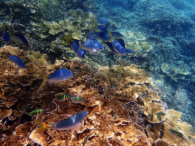
Great Barrier Reef Facts For Kids – The Largest Reef System in the World
The Great Barrier Reef is one of the largest reef systems in the world so we have gathered some amazing great barrier reef facts for kids. It is called a system because it is made up of almost 3000 small reefs and 900 small islands that stretch about 2600 Kilometers (1600 miles) long along the…
Written by