Category: Geography
-
Sydney Harbour Bridge Facts for Kids
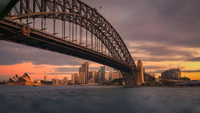
It is a half-through arch bridge that connects the North Shore with Sydney central business district (CBD). Due to its unique design, it is often referred to as ‘The Coathanger’. The design of this bridge was conceived by Dorman Long and Co Ltd, a British firm based in Middlesbrough. On the opening parties of the…
Written by
-
Tower Bridge Facts for Kids | Hallmark of London
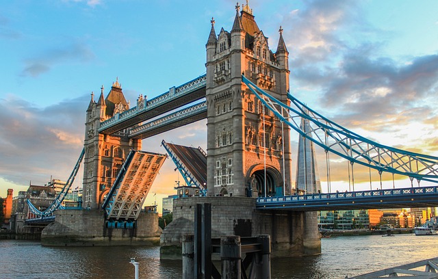
Tower Bridge is a suspension bridge of London. It has been an iconic symbol of this city as it passes over River Thames. It is a bascule bridge, which means it is moveable and gives way to boat traffic when required thanks to the upward swing of the bridge. Its maintenance and ownership is under…
Written by
-
River Thames Facts – The Longest River in England
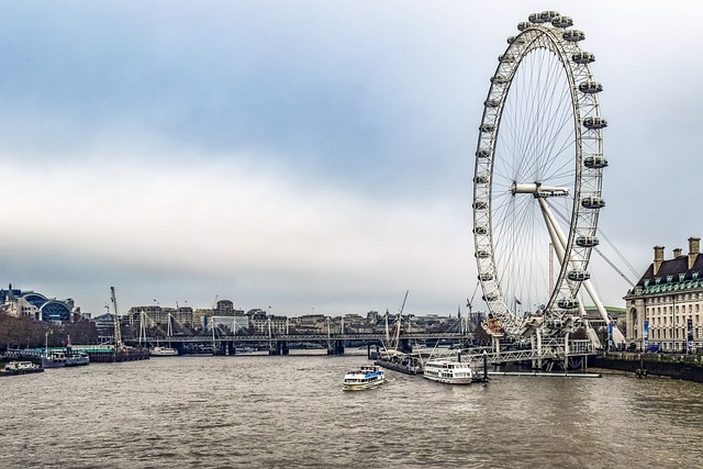
River Thames is the longest river in England and the second longest river in the United Kingdom with a length of about 215 miles. It flows through southern England, starting from Gloucestershire Cotswolds to North Sea. It passes through eight English counties and flow alongside some of the major towns and cities such as Oxford, Richmond, Kingston upon…
Written by
-
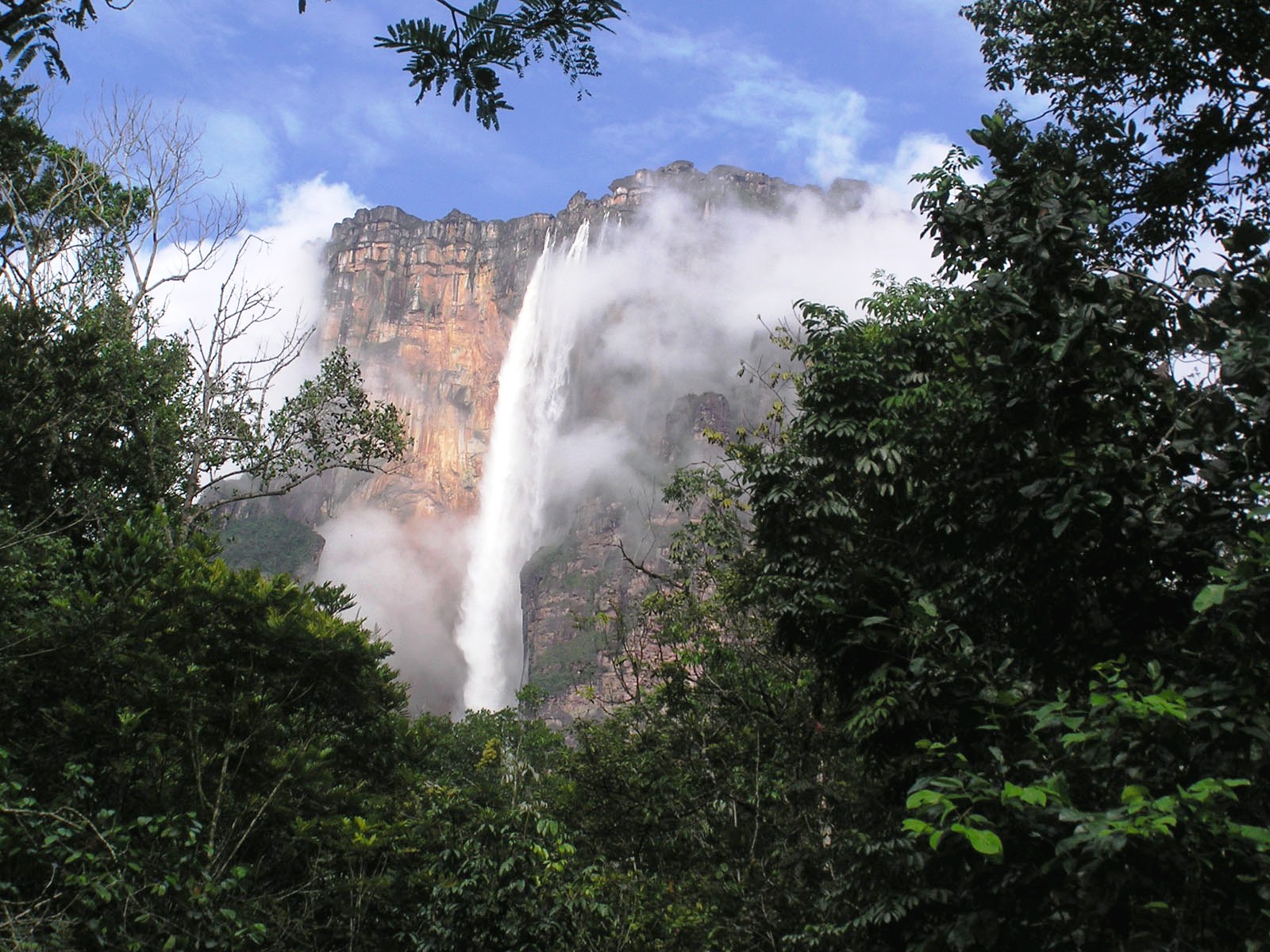
Angel Falls Facts for Kids | World’s Highest Waterfall
Located in a jungle in Bolívar State of Venezuela, the angel falls is clearly one of the most fascinating sights to watch. The height of angel falls makes it the highest uninterrupted waterfall in the world. The angel falls gets its name in the 20th century. The waterfall is named after an American aviator called…
Written by
-
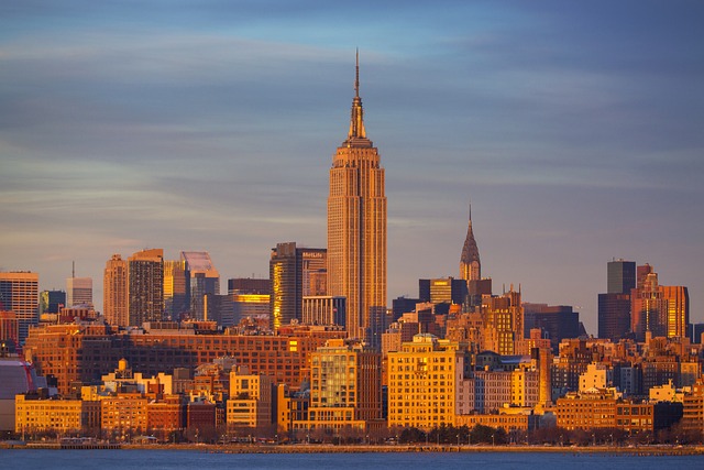
Empire State Building Facts for Kids
Located in midtown of New York City, this skyscraper has 102 stories. The empire state building is a cultural icon of USA. It is built on a design known as Art Deco style. On 1 May, 1931, the button for the lights of the empire state building was pressed by US President Herbert Hoover. It…
Written by
-
North America Facts For Kids | History, Geography, People
North America is one of the largest continents in the world—third only to Asia and Africa. The America is not only rich in wild animals it also tells us facts about the long history of indigenous people including the European colonization. The North America’s land mass consists of Republic of Mexico, Canada, and United States.…
Written by
-
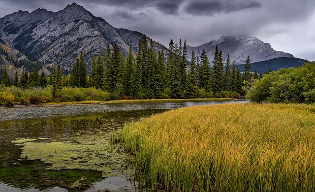
Rocky Mountain National Park Facts | Geography, Flora & Fauna, Climate
The Rocky Mountain National Park lies in the northern Colorado. It is thought to occupy 1,040 square kilometers of land. The park offers one of the magnificent hiking trails that include alpine lakes, flower-studded valleys, and summer assaults which can be challenging even for expert climbers. Every year it attracts more than 3 million visitors.…
Written by
-
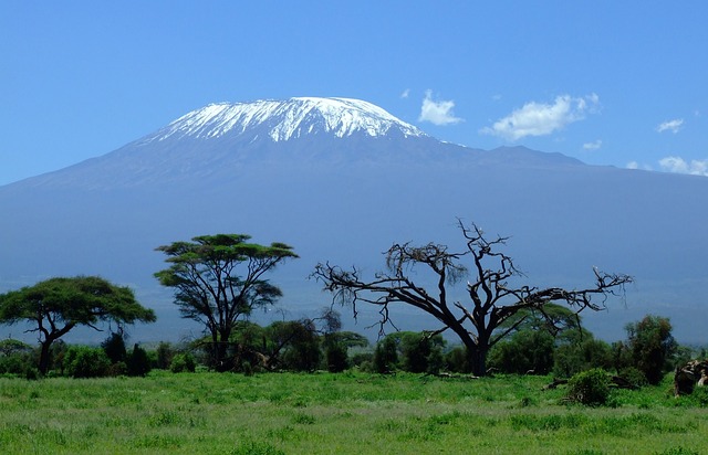
Mount Kilimanjaro Facts For Kids | Highest Peak of Africa
The Mount Kilimanjaro is not only the largest mountain in Africa it is also the world’s tallest freestanding mountain reaching 19,340 feet above the sea level. The meaning of Kilimanjaro means the ‘Mountain of Greatness’. It is the most familiar snow-capped mountain throughout the Africa. Currently, it is a stratovolcano and the mount lies in…
Written by
-
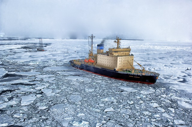
Arctic Facts For Kids | Animals, Plants, People, Weather
The Arctic is home to many animals and humans especially those that have adapted to living in extreme cold climates. No wonder it is one of the most spectacular landscapes on earth that is covered almost entirely with ice sheets. The ice is just about everywhere and remains there for millions of years. The Arctic…
Written by
-
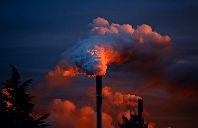
Air Pollution for Kids | Types, Sources and Effects
Smoke is one of the forms of air pollution. Various natural sources emit smoke into the atmosphere. Humans are mainly responsible for making the air dirty because man-made activities result in producing a large amount of hazardous substances in the air. These substances are so toxic that they actually change the composition of gases in…
Written by
-
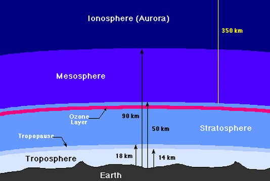
Layers of the Atmosphere for Kids
The atmosphere of the earth is made up of a mixture of gases. This pool of gases behaves like a ‘filter’ and saves us from harmful radiation of the sun. In a group, these atmospheric gases behave as one unit which we label it as air. Since gravitational force of the earth attracts everything downward,…
Written by
-
Greenhouse Effect for Kids | Meaning and Causes
In 1824, the process of greenhouse effect was first noticed by a French physicist named Joseph Fourier. He was the first scientist to consider that the atmosphere of our planet may be similar to that of an insulator that reflects the earth’s radiation back toward its surface. The average temperature on the earth is about…
Written by
-
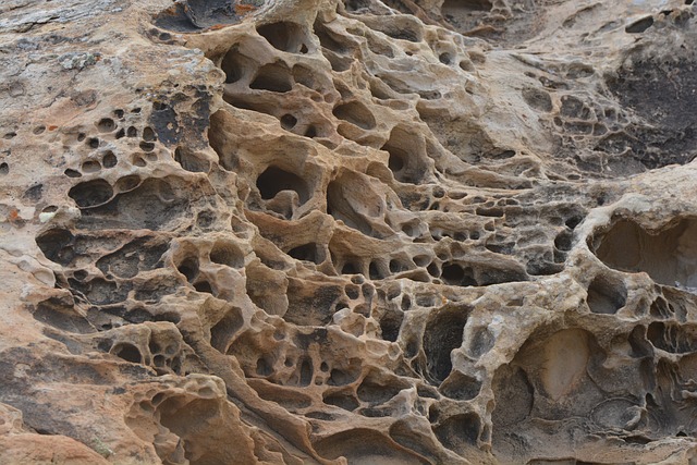
Metamorphic Rocks for Kids | Origin and Classification
Metamorphic rocks for kids brings to you some of the interesting facts about these rocks. To begin with, the word ‘Metamorphism’ comes from joining two Greek words i.e., meta meaning ‘change’ and morpho refers to ‘shape’. It means metamorphism means ‘to change shape’. Metamorphism is a process in which high temperature and pressure changes the mineral…
Written by
-
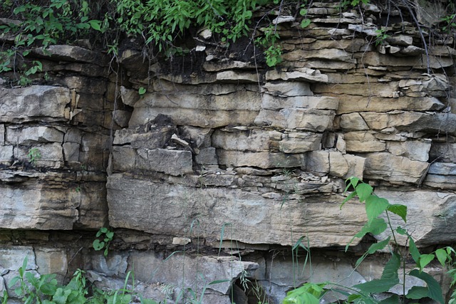
Sedimentary Rocks for Kids | Origin and Classification
When a solid rock is exposed to air, the air cuts loose tiny particles from the surface of rock. This geological process in which air wears down small fragments of rock by its continuous flow is known as weathering. Weathering disintegrates solid rock both physically and chemically and in doing so, it changes the texture…
Written by
-
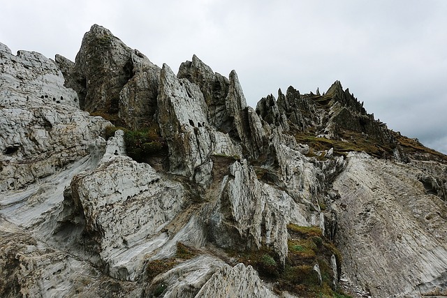
Igneous Rocks for Kids | Origin and Classification
Igneous rocks for kids brings some of the interesting and basic facts about these rocks. The interior of the earth is extremely hot. The overlying layers of rocks exert a lot of pressure upon the rocks lying underneath them which is why most of the earth’s interior exists in solid form. At the same time,…
Written by
-
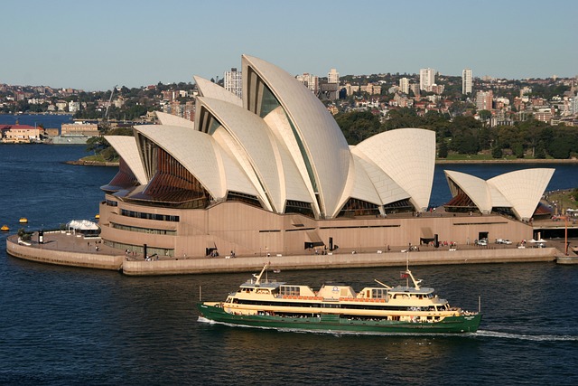
Sydney Opera House Facts for Kids | Venue for Art Performances
Located on the dock of the most densely populated Australian city, Sydney Opera House is a venue for various art performances. The natural harbor of Sydney where this building is situated is known as Port Jackson and this location is referred to as Bennelong Point. It was constructed by a Danish architect namely Jørn Utzon.…
Written by
-
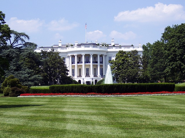
White House Facts For Kids | Official Residence Of The US President
White House is an office as well as home for the President of USA. Every US President uses it as his home and this tradition began in 1800 from the time of second US President named John Adams. The word ‘White House’ was not the original name of this house. The original name was the…
Written by
-
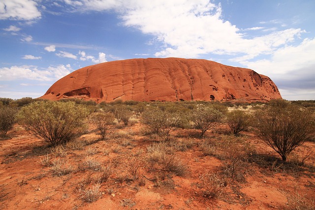
Uluru Facts For Kids | Historical landmark Of Australia
Uluru is a small hill in Australia and is usually referred to as Monadnock. It is also known as inselberg which means ‘island mountain’. An inselberg is the name of a hill that sticks out suddenly above the land. Located in Central Australia, Uluru is a huge formation of rock. It is made up of…
Written by
-
Sahara Desert Facts For Kids | Hottest Desert Of The World
Sahara desert is the world’s hottest desert. The size of Sahara is almost equal to the size of China which makes it third biggest all over the world. It covers most of the area of Africa and extends from the Red Sea to the Atlantic Ocean. There are few sand dunes in Sahara that have…
Written by
-
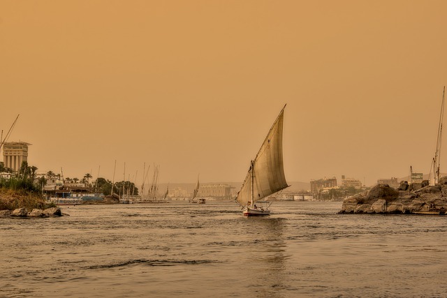
River Nile Facts For Kids | Longest River Of The World
River Nile is the world’s longest river. It supplies water to 11 countries but it is the main water source for two countries: Egypt and Sudan. That is why it is also called ‘International River’. There are two tributaries of River Nile. These are Blue Nile and White Nile. The mouth of this river is…
Written by